Annual
$59.99/year
Best value · about $5/month
Tip: double-click the map, or drag the route line, to add a stop or steering point.
Estimate the whole trip, or compare departure times separately for each overnight destination and the final destination. Fuel stops are included in each day’s travel time.
Saved to your account when signed in and cached on this device for offline routing and clearance checks.
Manage your account, RV profile, and default planning preferences.
Tunnel operators post different limits. Maryland's Fort McHenry and Baltimore Harbor tunnels allow bottled propane up to 10 lb per bottle (10 bottles max); Virginia's Roanoke Airport Tunnel allows none.
ClearRoute covers the United States and Canada using its own routing service. No API keys or setup are needed.

Sign in to create a support ticket or send a feature request.
Open the owner dashboard for analytics and operations, or use the access tools below.
New user? Send an invitation from this section.
They’ll receive the code, setup instructions, and a QR invitation link.
The recipient must already have a ClearRoute account.
Review the newest POI experiences and permanently remove inappropriate comments and photos.
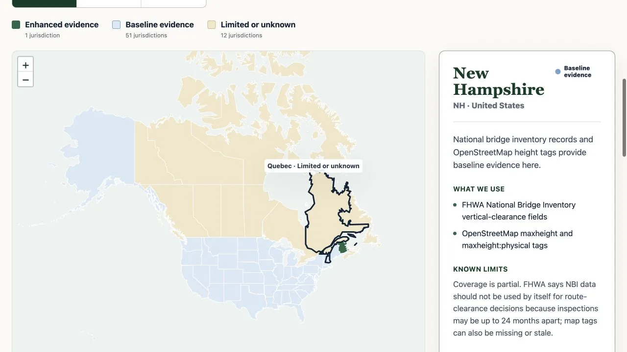
Coverage is partial — assist, not guarantee.
Clearance data is amalgamated from the FHWA National Bridge Inventory (US),
Canadian provincial open data, and OSM maxheight tags. Coverage
is incomplete and overhead wires are assumed code-compliant (≥15.5 ft).
Always obey posted height signs and verify in person.
Explore coverage by state and province.
Guidance has limits. Maps, routes, clearances, restrictions, closures, traffic, speed limits, and other data may be incomplete, delayed, inaccurate, or unavailable.
The driver remains responsible. You must obey posted signs, verify every road and structure is suitable, and stop or choose another route whenever conditions are uncertain.
Assumption of risk and release. To the maximum extent permitted by law, you assume the risks of using ClearRoute RV and agree to the release terms covering ClearRoute RV, Cold Harbor Labs, and their owners, creators, contributors, employees, and agents.
Read the complete agreement Agreement version 2026-07-15Traveler reports, not verified facts. Check current signs, conditions, and official sources before relying on a warning.
Sign in or create a free account to share an experience, praise, or warning.
Share only relevant, truthful RV travel experiences and photos you have permission to share. No harassment, hate, sexual content, graphic violence, threats, illegal activity, spam, private personal information, or dangerous advice. Text and photos require review before publication. Community reports never replace posted restrictions or verified route guidance. We may remove content or suspend community posting for violations.
Favorites are private to your account and available on every signed-in device.
No favorites yet.
Signed-in trips are saved to your account and available on every device. Each trip remembers its stops and RV profile.
No saved trips yet. Plan a route, then tap Save this trip.
Saved on this device and synced to your account when signed in. Trips also keep their stops and current RV profile.
Plan around low clearances, posted weights, no-RV roads, propane rules, dangerous grades, and live road events — then navigate with the same route on every screen.
One complete membership. No stripped-down planner tier.
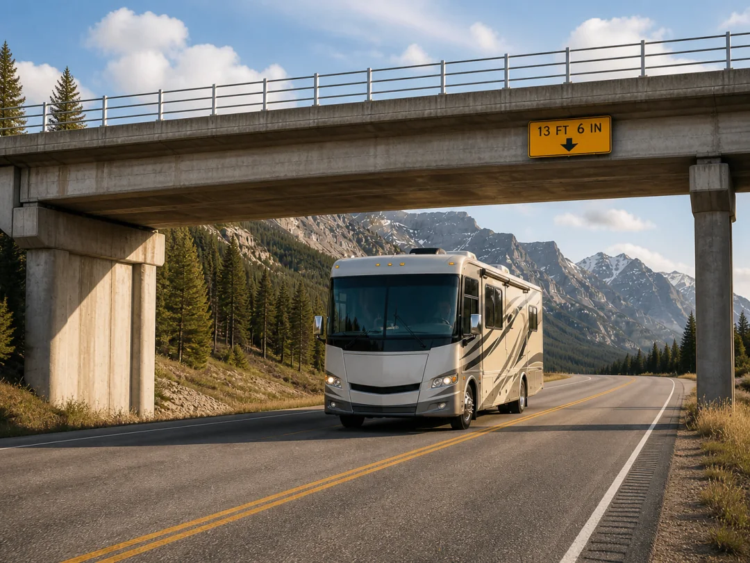
RV-specific planning
28,534 clearance records
Planner-to-navigation continuity
The planner
Height, weight, length, towing setup, propane, fuel range, and grade comfort become part of every route decision.
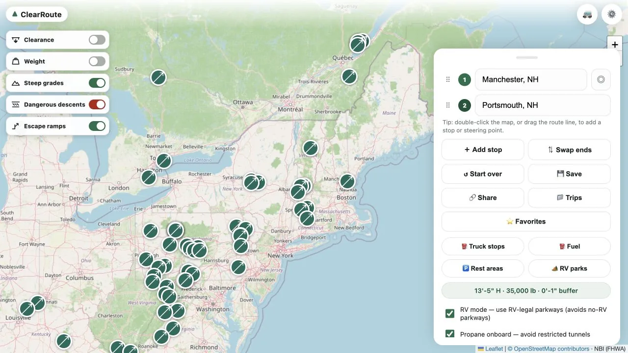
Check known height evidence against your actual rig.
Account for bridge and roadway limits before departure.
Keep restricted parkways and unsuitable roads out of the plan.
Apply tunnel and hazmat restrictions when propane is onboard.
See grades in the context of your rig and comfort settings.
Bring available public-agency closures and restrictions into view.
From planning to the driver's seat
The driver follows ClearRoute on CarPlay while a passenger checks the route and finds the next useful stop on the phone.
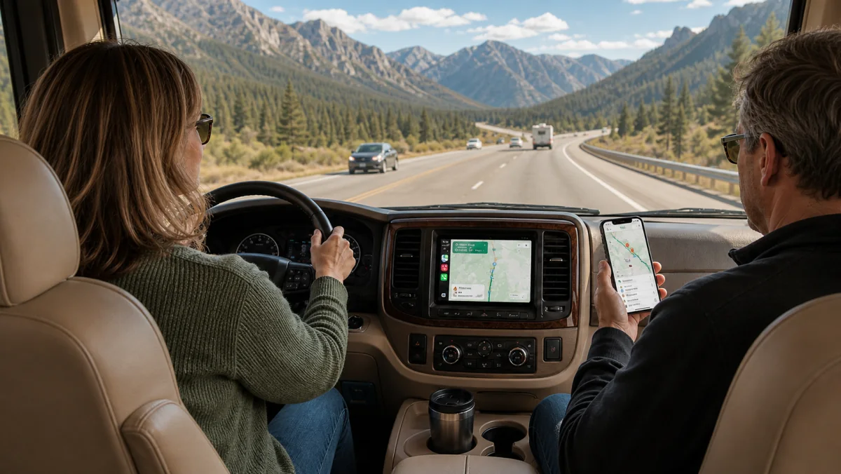
Follows the RV-safe route on CarPlay with the next move and road alerts in view.
Checks the same trip and searches ahead for fuel, RV parks, groceries, and more.
Coverage transparency
ClearRoute's current U.S. and Canada catalog includes 28,534 clearance records. Explore the public evidence behind height, weight, and grade guidance — state by state and province by province.
Explore the safety data mapCoverage describes available evidence, not every road. Always obey posted signs.
Membership
Choose the billing rhythm that works for you. Both plans include the complete ClearRoute experience.
Annual
$59.99/year
Best value · about $5/month
Monthly
$9.99/month
Flexible month-to-month billing
RV-specific planning, safety layers, route sync, turn-by-turn navigation, available live road events, and future member features.
Trials are available by request or through a single-use code from our staff. One trial per account.